Site Location: Mid-West Oxfordshire
Related Achive: Manning
Percy Manning mentions many ancient sites in the Wychwood Forest area.
The area around Wychwood was inhabited long before it became a royal forest. Neolithic and Bronze Age barrows can still be seen. There are two long barrows and two round barrows inside the private Cornbury Park, and Waterman's Lodge barrow sites just outside the private portion to the north west, as well as the barrows at Leafield, Ramsden, Asthall and Glympton. Roman roads and villas have been located. The Saxons settled in the area and the name comes from the Saxon 'Hwiccewudu', the local tribe. In the late 10th/early 11th century a royal hunting lodge was built at Woodstock.
Wychwood is listed in the Domesday Book as a Royal Forest and consisted of 182 square miles. Not all the forest was wooded, forest (Latin-foris) is a legal term meaning piece of land.
Henry I created a hunting park in Woodstock (later named Blenheim), surrounded the grounds with a stone wall, seven miles long. He filled the park with foreign beasts.
Its greatest size was in the late 12th century, and stretched from Taynton to Woodstock, Chipping Norton to Northmoor. In 1300 the forest was divided into 3 parks, Woodstock, Cornbury and Witney. In the 12th and 13th centuries many forest villages were founded.
In 1704 Woodstock was given to the Duke of Marlborough, who renamed the park Blenheim. Cornbury was by then in private hands.
A massive amount of the trees were felled over the centuries for ship building. By the late 18th century only 1501 hectares remained.
The remaining woodland was enclosed in 1867 as it is today - 870 hectares.
The forest has many tales of folklore and traditions. See Wychwood Project and Wychwood History.
(More information about Cornbury Park)
References:
R. Plot, Natural History of Oxfordshire (1677)
Victoria County History of Oxfordshire, Vol II, p293 (forest) & p343-348 (barrows) |
Site Photographs |
Click on picture to see a larger image |
|
|
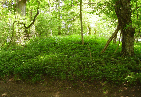
One of the Waterman's Lodge Barrows, just by the track into the forest
(June 2006) |
|
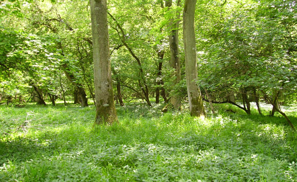
This second barrow sits behind the one above, not so defined
(June 2006) |
|
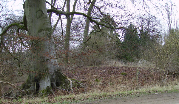
Possible third barrow opposite drive to Waterman's Lodge, right by the road
(April 2006) |
|
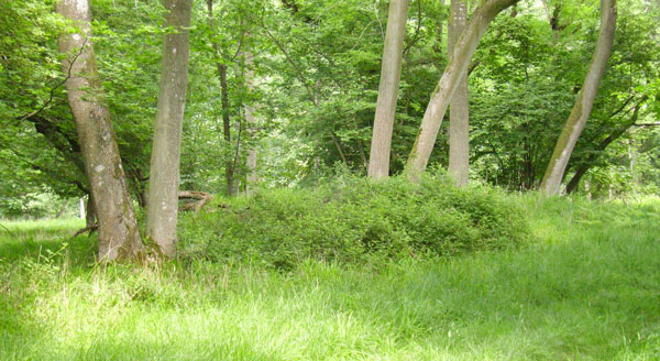
Churchill Copse Long Barrow, right by the trackway
(June 2006) |
|
Slatepits Copse Long Barrow, showing portal stones
(June 2006) |
|