Site Location: Central Oxfordshire
Related Achive: Manning
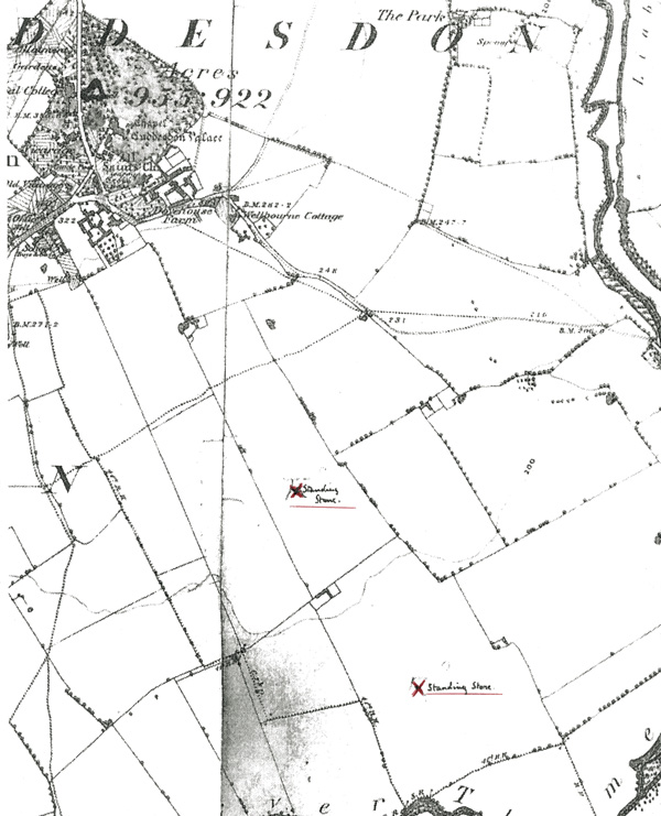
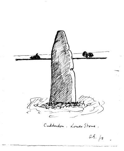
There is reference in Percy Manning's records of 'The Cuddesdon Stones'. Correspondence between him and Angus Graham mentions a map and instructions how to find them. There is also a drawing of 'The Lower Stone' and a black and white photograph of 'The Upper Stone'. The stones are annotated on the Ashmolean's copy of the Ordnance Survey map of 1889. However, so far these are the only documentary references to the stones. The Sites and Monuments Record at County Archaeology have no information in their records. Local inhabitants have stated that the stones were removed sometime in the 1980s. No trace of them has been found at the present time. (Further information on the whereabouts of these stones would be appreciated)
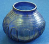
The blue glass bowl is one of two found with other objects in the Bishop of Oxford's Palace grounds, when work was being carried out near the gateway in 1847 (the palace was built in 1635). The quality of the objects suggest a high status Anglo-Saxon pagan burial site. Inhumation burials, iron swords, a bronze bucket and pottery sherds are amongst the other objects discovered. Cuddesdon has been a religious site since the 900s, All Saint's Church probably originates from this time, the present building dates from around 1150. The palace was burnt down at least four times over the centuries, the last time in the 1960s when it was demolished. Opposite the site of the old palace, a new theological college was opened in 1954.
References:
Correspondence between Percy Manning and Angus Graham, 1913 (for the stones)
J.Y. Akerman, Pagan Saxondum, 1855, pp11, 28
Antiquaries Journal, Vol XXIX, 1916, p49
Archaeolgical Journal, Vol 71, 1920-21, p239
British Arch. Reports, Cuddesdon and Dorchester on Thames, 1974
Victoria County History of Oxfordshire, Vol V, p100
Victoria County History of Oxfordshire, Vol I, p352
|
Documents |
Click on picture to see a larger image |
|
The Cuddesdon Stones marked on the Ordnance Survey Map of 1889 |
|
|
Cuddesdon Lower Stone |
|
|
Object Photographs
|
|
Cuddesdon Bowl (AN1980.269) |
| |
|