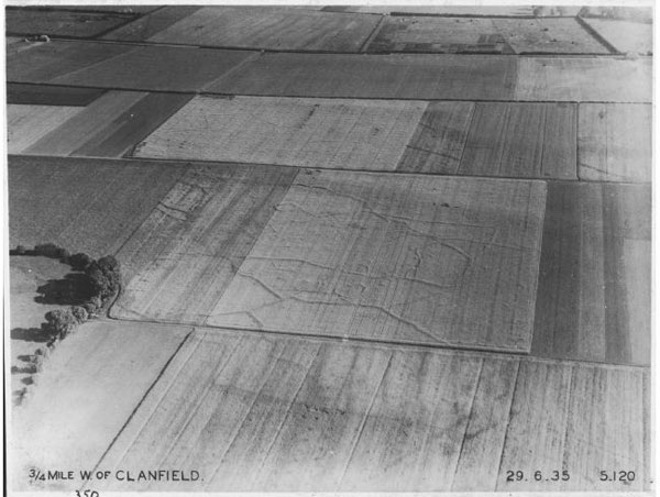
Other features have seen been identified at Clanfield including a 'sub-rectangular enclosure', consisting of a double ditched large rectangular enclosure within which are a series of vague circular and rectangular enclosures (see aerial photograph).
Various cropmarks at Clanfield can be identified on aerial photographs taken by Major G.W.G. Allen in 1930's, some of which were also recorded by Percy Manning.
References:
Old O.S. map (barrow)
Victoria County History of Oxfordshire, Vol II, p328 (Friar's Court)
Aerial Photographs
Click on picture to see a larger image
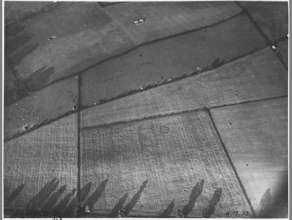
Cropmarks at Clanfield taken by Major Allen on 4 July 1933 (Ref Album 2,55) - photograph referred to by Manning archive ID no 244
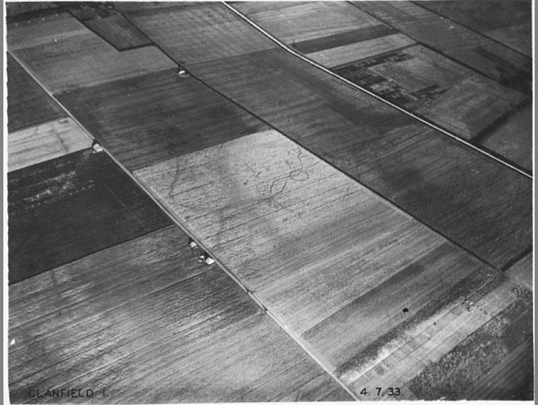
Cropmarks at Clanfield including a possible barrow taken by Major Allen on 4 July 1933 (Ref Album 2,54)
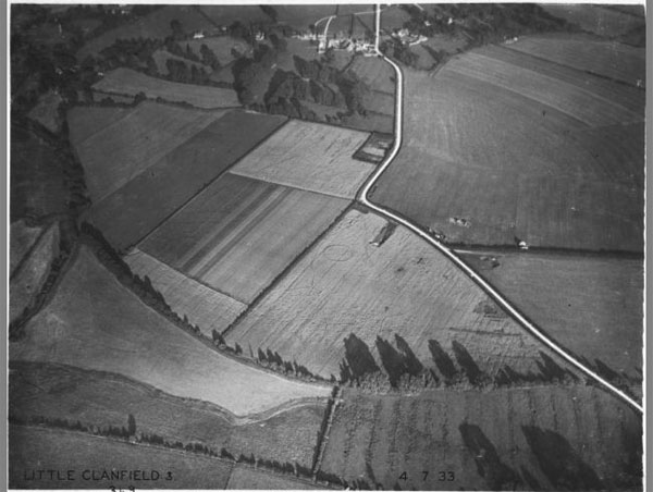
Cropmarks to the east of Little Clanfield including a circular feature by Major Allen on 4 July 1933 (Ref Album 2,56)
'Sub-rectangular enclosure' to the west of Clanfield taken by Major Allen on 29 June 1935 (Ref Album 9,76)